
Prescott Valley Past-Resident Time Layers
A backward address search works best when the source matches the era. Prescott Valley became an incorporated town in 1978, and its first subdivision unit dates to 1966. Earlier land may appear under Lonesome Valley, ranch, township, range, county, or plat language rather than the later town name. The current parcel and legal description provide the bridge. They can lead into the county deed index, tax history, dated imagery, permits, directories, and regional archives without assuming that modern address text existed in each source.
| Source | Years It Covers | Where Held | What It Shows |
|---|---|---|---|
| Recorder general index | Current county claim: 1904 to present | Yavapai County Recorder | Indexed parties, instrument, date, land transfer |
| Plats and surveys | 1864 to present | Recorder | Subdivision, lot, survey, and legal geography |
| Assessor and GIS | Current roll with sales and lineage | County parcel portal | Owner, situs, mailing, APN, legal land, improvements |
| Treasurer inquiry | Generally ten prior tax years | Yavapai County Treasurer | Taxpayer, value, payment, owner and split trail |
| Integrated permits | Mainly mid-2000s forward | GIS and Town custodian | Work and dated owner or applicant context |
| Federal census | Public through 1950 | NARA and library access | Household at the census date in historic geography |
| Regional directories | Discrete editions, not a continuous run | Arizona Memory and Sharlot Hall | Dated name-first or address-first clues if covered |
The deed chain is the strongest starting line for an existing Prescott Valley parcel. Household sources then test who may have lived there at a certain date. A permit can date work, and an aerial can date visible growth, but neither names all past residents.
Trace Yavapai County Past Owners
Begin in the Yavapai County parcel search. Enter the physical address without city, state, or ZIP, then copy the parcel number, exact legal description, current owner, and recorded sale link. Open the current acquisition deed or search that owner in the Recorder system. The deed’s seller is the next person to search as an earlier buyer. Repeat while checking the same lot, legal description, and parcel lineage.
- Confirm the current parcel and assessed owner. Save the situs, APN, subdivision, lot, and legal description.
- Find the present owner’s acquisition deed. Record the grantor, grantee, date, document type, and book-page or reception number.
- Search the seller as an earlier grantee. Try name variants, initials, trusts, and entities in both party roles.
- Compare the legal land on every hit. When the APN changes, use Parcel History and the recorded plat to connect old and new identifiers.
- Ask the Recorder about a specific early book or image when the online layer ends. Bring the party and locator because staff do not build the chain.
- Add tax, permit, aerial, directory, census, obituary, and probate evidence for the dates each one can actually support.
The Prescott Valley process does not guarantee a legal chain of title. It creates a research trail that can be checked against official copies. A title question calls for qualified professional help, while the Recorder supplies records and certified copies rather than a conclusion.
- Grantor and grantee
- The grantor transfers an interest; the grantee receives it. Search both roles when walking backward.
- Chain of title
- The sequence of recorded transfers affecting the same land. An index is a finding aid, not a guarantee that the chain is complete.
- Legal description
- The lot-block, section-township-range, or other land description that stays useful when a street or ZIP label changes.
- Parcel history
- The assessor link between earlier and current parcel numbers after land splits or combinations.
Prescott Valley Past-Resident Recorder Layers
The official Recorder search landing page points to the county index and document access. The current county statement places verified general indexing at January 1, 1904 to the present and maps and surveys at 1864 to the present. An older instruction PDF describes public online documents from 1973, while older copy language refers to unofficial images from 1976. These claims can coexist because index depth and image depth are separate.
The Recorder document-search landing page leads into the screen shown below.
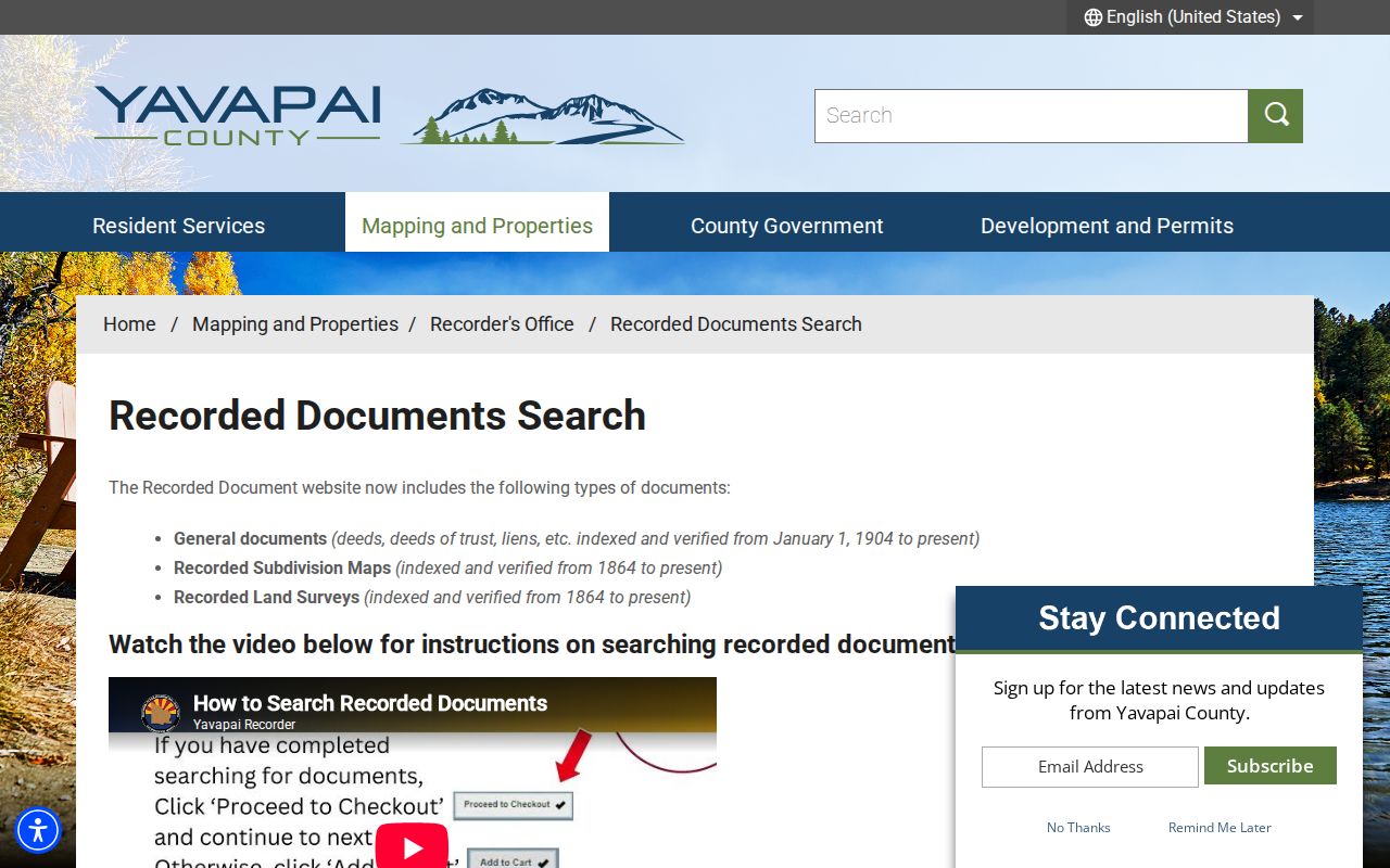
For Prescott Valley work, the screen is a gateway, not an address index. Search grantor or grantee in LASTNAME FIRSTNAME form, add dates or a document locator, and compare the legal description before accepting a match.
Note: For a pre-1976 item, ask whether the index entry, image, and certified copy are available through different channels.
Prescott Valley Past-Resident Deed Copies
A Prescott Valley online result can show indexed parties and roles, recording date, document type, legal-description text where indexed, and a book-page or reception number. Available images are watermarked as unofficial. The purchase path offers official or certified copies, with certified copies mailed. The Recorder lists $1 per page and $3 certification per document.
A written copy request needs the document type and date, at least one party with role, and the right locator: book and page for a pre-2014 document or reception number after 2013. It also needs the requester’s contact and delivery details. Mail requests use a self-addressed stamped envelope. The Prescott office at 1015 Fair Street and the Cottonwood annex provide in-person channels; both list weekday hours with an 11 a.m. to noon closure.
Open-ended Prescott Valley address, parcel, legal-description, or chain research is outside the staff service. A focused search can take seven working days. That makes careful notes from the parcel roll and online index essential before a counter, phone, or mail request.
Prescott Valley Past-Resident Parcel Roots
Prescott Valley’s land story explains why older searches fail under the modern place name. Yavapai County was formed in 1864. Ranch families worked Lonesome Valley long before the first Prescott Valley subdivision unit in 1966. By 1972, twenty units held almost 12,000 lots across nearly 5.5 square miles, with more lots added in nearby developments. Incorporation came in 1978.
For a parcel older than the Town label, work from the modern APN to its prior parcel number, plat, legal description, and township or range. Then check ranch, county, Prescott-area, and archive sources using that historic geography. Searching only the words “Prescott Valley” before 1966 can miss the land entirely. This local shift is one of the most useful clues for previous residents research.
Prescott Valley Households Across Years
Prescott Valley ownership and occupancy are different. A deed can name a buyer who never lived at the site. A directory or census may name people at a date without proving an ownership interest. Pair the sources on a timeline, and keep the publication or enumeration date beside every name.
- Choose a deed date and establish the land identity with the legal description, not just the street line.
- Check the closest directory edition that truly covers the community. Read the coverage and abbreviation key before using an entry.
- Use the 1950 census only for historic geography that existed then. The public census predates the first Prescott Valley subdivision and later Town.
- Compare newspapers, yearbooks, tax rolls, permits, and archive files between the fixed census and directory dates.
- Record contradictions instead of merging them. An owner, payer, permit applicant, and household member can be four different people.
The ten digitized Prescott and Yavapai directories range across discrete editions from 1903-04 to 1963, not a full annual run. The Prescott Valley directory collections explain those editions in their own context. For house history, use only a verified address match and note the place coverage.
Prescott Valley Past-Resident Criss-Cross Caveat
The 1963 Luskey’s volume is address first. A sample entry has a street heading, house number, occupant initials and surname, and telephone number. Its coverage includes Prescott and several named Yavapai communities. That makes it a strong example of how a criss-cross source works, but not proof that every later Prescott Valley street appears. The Town did not yet exist as an incorporated place, and the exact local run has not been verified.
When a Prescott Valley street is absent, test the plat date and earlier geography before calling it an occupancy gap. The subdivision may not have been built, the road may have another form, or the directory may not cover that tract. The unexplained asterisk in the Luskey’s sample should also be checked against the volume key rather than guessed.
Ask Sharlot Hall Precisely
The Sharlot Hall Research Center in Prescott holds regional directories, maps, manuscripts, photos, oral histories, newspapers, funeral records, court material, and community collections. Research visits require an appointment. The center lists Wednesday through Friday noon to 4 p.m. and Saturday 10 a.m. to 2 p.m. admission as open and free. Phone or email requests receive thirty free staff minutes, with a typical two-to-three-business-week response, then $25 per hour.
A precise Prescott Valley request saves that time. Supply a person, month and year, road or historic place, subdivision or legal description, and the records already checked. The center’s detailed residency source guide often works at the month level. Remote scanned pages are listed at $2 per page. Prescott Public Library adds in-library genealogy databases, historic newspapers, and Digital Sanborn Maps, but no Prescott Valley Sanborn sheet was verified.
Note: Prescott Valley’s modern buildout may postdate classic Sanborn coverage, so dated aerials, plats, and permit evidence are often better fits.
Bridge Prescott Valley ZIP History
USPS moved 3,059 Prescott Valley delivery points from 86314 to the new 86315 last line on July 1, 2006. The old ZIP remained usable during a one-year transition. A person or house can therefore appear under two ZIPs without moving. Search both forms in sources around 2006 and 2007, but use the parcel number and legal description to decide whether the land is the same.
A Prescott Valley postal line also does not prove the parcel sits inside Town limits. Northern and fringe delivery areas may be outside the incorporated boundary. GIS jurisdiction layers determine which permit or code custodian holds a record. Postal continuity supports the address trail, while parcel continuity controls the land trail.
Prescott Valley Past-Resident Trail Endpoints
A Prescott Valley obituary, probate file, or funeral record can extend the story after a past owner leaves or dies. Sharlot Hall maintains obituary, death and disposition, cemetery, and funeral-home databases with regional material. An obituary can name relatives, a service place, burial, occupation, or group ties. It is a dated narrative source and should be checked against the deed and court trail.
Prescott Valley probate records come from the Clerk of Superior Court, not the statewide Public Access display, which excludes probate. A public case file may name a decedent, personal representative, heirs or devisees, and notice addresses, subject to seals and redactions. Recorded beneficiary or personal-representative deeds can link the court event back to the parcel. Notice addresses may be historic, not current.
Prescott Valley Previous Residents Limits
Prescott Valley past residents are not the same as past owners. The assessed owner, tax mailing addressee, deed party, permit applicant, directory occupant, and census household each describe a distinct role on a distinct date. A directory gap is not proof that a house stood empty. It may reflect missing coverage, historic geography, a late plat, a variant road name, or a source that omitted the tract.
Use Prescott Valley past-resident research to build a careful house or family history. Cite the source and date beside each fact. Preserve uncertain matches as uncertain. Protected addresses, sealed files, and private household data remain outside the record trail, even when another public clue exists.
Lawful use. Prescott Valley house-history records support personal, genealogical, and civic research. Do not use them to track, harass, threaten, or expose any living person.